Part 1 of the UL Research Institutes’ Fire Safety Research Institute that was commissioned by Governor Gavin Newsom after the January 2025 fires was released today. This report focuses solely on the timeline of the Palisades and Eaton Fires.
The Research Institute report was based on a multitude of sources, including on-the-ground damage assessments, images (still images or videos), weather reports, radio communication recordings, radio transcripts, dispatch records, resource requests, resource location data, conversations with residents and technical discussions with individuals from many involved organizations and agencies.
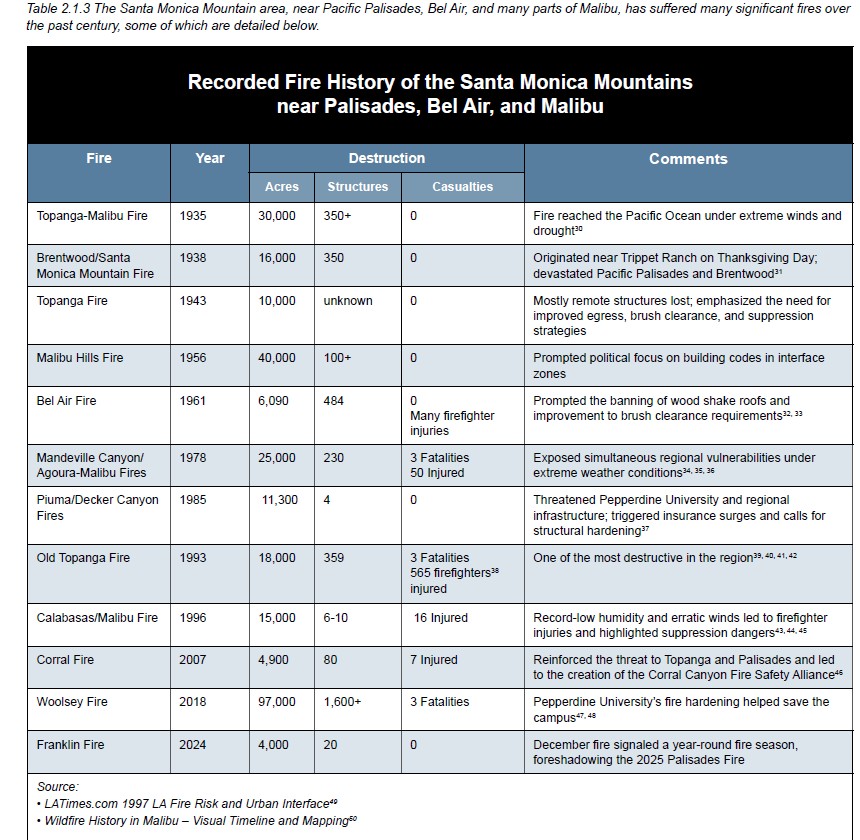
The 347-page document, Learn Key Events Leading Up to and During the LA Wildfires 2025 | Fire Safety Research Institute provides a lengthy background on the land and history of this area and notes “The Indigenous peoples of Southern California actively cultivated the Pacific Palisades landscape, practicing controlled burns, brush clearing, and native planting, which sustained a natural, fire resilient ecosystem. . . .
“Today, the area contains more than 8,000 structures and more than 21,000 residents situated among highly combustible vegetation on steep terrain. As seen in the Palisades Fire, once fire ignites under wind-driven conditions, embercast and steep slopes allow rapid fire spread across communities with limited ingress/egress and challenging topography.”
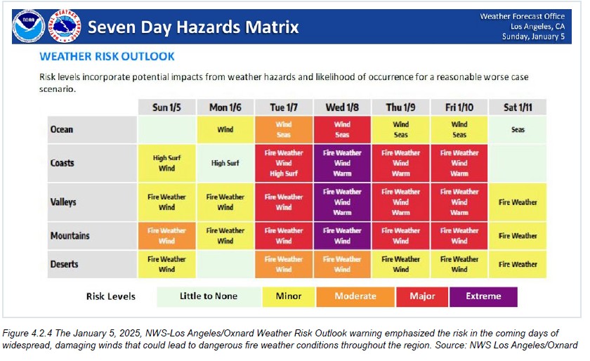
The report lists weather stations, fire stations, law enforcement stations, emergency management resources, radio communications, incident command system designation and even the weather risk outlook before the fire.
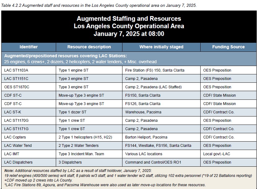
Governor Gavin Newsom said there had been predeployed resources to the Palisades area.
On p. 91, the report notes that “The LSR (local storm report) is a brief, real-time text product from National Weather Service that summarizes significant and specific severe weather events based on information from on-the ground sources, such as storm spotters, public safety officials, emergency management, news media, and the public.
“There were no LSR damage entries for the Palisades Fire area just prior to 10:30 on January 7, 2025. However, law enforcement officers and firefighters encountered many downed trees/branches, utility poles, and overhead wires in the streets throughout the burn area that were not recorded in the system.
“Anecdotal video and photographic evidence suggests widespread powerline and tree damage was not reported to NWS due to the ongoing fire emergencies.” (Editor’s note: I’ve now made two public requests to the DWP about the number of poles destroyed and power lines down in the Palisades – and the last year that new poles were installed. A firefighter told me that trying to fight the fire was made more difficult because the power was on and “live” wires were in the streets.)
To go to the Fireline Progression, jump to p.100. It starts at 10:30 a.m. on January 7 and goes to January 8. Readers can see if the report accurately reflects their experience.
The Phase Two report will provide a comprehensive analysis of the January 2025 fires, including preexisting conditions in the fire areas, the influence of the built environment on fire behavior during extreme events, first responders’ actions at decisive points in the firefighting operations and emergency response agencies’ capabilities for addressing urban conflagrations.
Once it is released, it will be shared with readers.

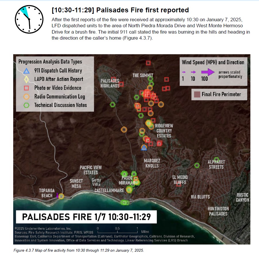

Interesting that they have a wind speed and direction symbol but the only place I see it on the map is at Topanga and it appears to show wind speeds of 10 mph or less. Why has it not been included elsewhere?
Because it takes away the fiction that the fire could not be stopped because it was “hurricane” winds (74 to 95 mph)
Sue
Read the paper today – now the new head of the fire department- been with the department for 30 years. He’s trying to blame the LA times for their investigation/exposure of the texts between battalion chief who told firemen to leave the Lachman fire. Thank gosh for the LA Times and their investigative work.
If you need a 15 minute interval from Jan 7 to Jan 9 of fire parameter and status along with wind speed and direction:
https://firerebuild.com/interactive-map/
I am not sure that the State is a neutral party in this report. Wasn’t the January 1st fire on State Property. I would have more confidence in a blue ribbon panel and independent research group collecting the data and report it. I’m sure the attorneys will be subpoenaing all information related to the fire from all government sources as well as private sources.
That should give us a much better picture.
I should not that the clock starts on January 7 not on January 1 in this report.